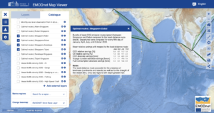
The EMOD-PACE (EMODnet PArtnership
for China and Europe) project now displays VISIR-2 routes on its map viewer.
 Least-CO2 routes of a 800 TEU feeder (a small container ship) calling at Singapore and other harbours along the maritime silk road can be explored via the viewer.
The routes were computed for several months and departures dates in 2020 and were documented in terms of both their CO2 and CII (Carbon Intensity Indicator) relative savings with respect to the least-distance route.
The vessel seakeeping is based on semi-empirical parametrisations selected in the frame of the PhD-thesis by Amal Salhi to be defended during the upcoming PhD-graduation session at the University of Bologna.
The EMOD-PACE project, which established a long term ocean data
collaboration between the National Marine Data and Information Service
of China (NMDIS) and the European Marine Observation Data Network
(EMODnet) was funded by the EU Partnership Instrument
(EuropeAid/139904/DH/SER/CN ‘Strengthening international ocean data
through the EU’s ocean diplomacy with China’).
Project video: https://www.youtube.com/watch?v=3ONwjZTI4uA